Skip to content
San Diego 360 Scans
Menu

What Is a Matterport Scan? A Plain-English Guide

What a Matterport scan is, how the Pro3 LiDAR scanner captures a space, what files you get, how accurate it is and who uses it in San Diego.

By Everett WeryPublished 4 min read
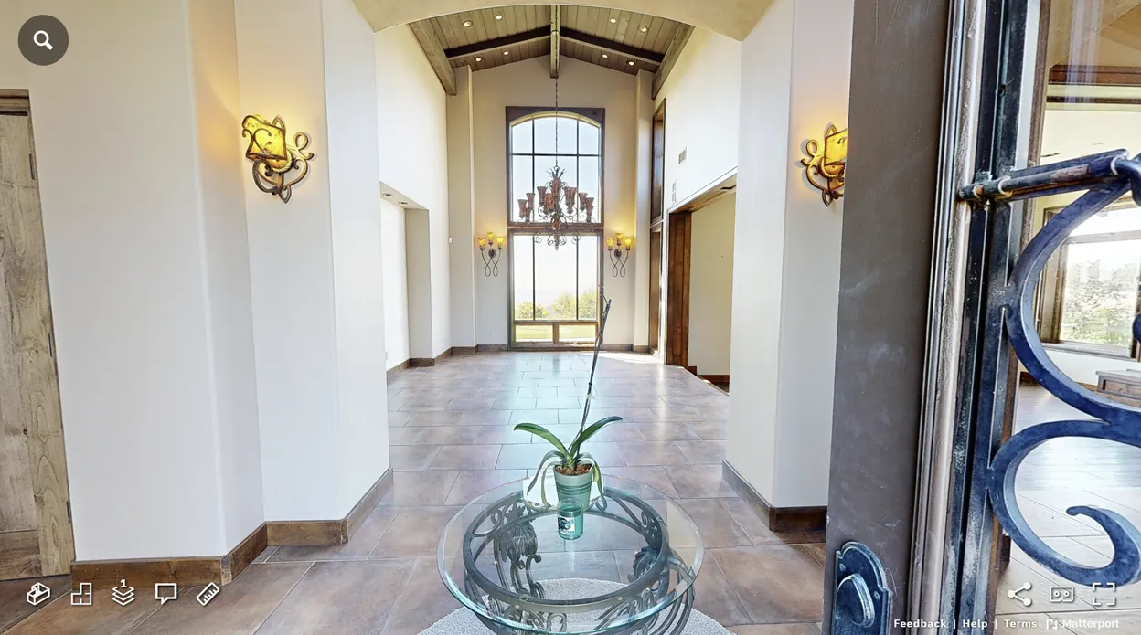
Matterport 3D tour view of a high-ceiling entry foyer captured with a Pro3 scanner

What is a Matterport scan?

A Matterport scan is a 3D capture of a building or property that becomes an interactive model you can walk through in a web browser. Visitors can move from room to room, look around in every direction, switch to a dollhouse view of the whole property and take measurements.

San Diego 360 Scans uses the Matterport Pro3, a LiDAR scanner. It works indoors and outdoors in direct sunlight, which means yards, building exteriors and multiple structures can be connected to the interior in a single model.

How the scan is captured

The scanner sits on a tripod and is moved every few feet through the space. At each position it takes a sweep, which takes under 20 seconds, combining laser distance data with photography. Matterport's software aligns the sweeps into one connected model.

To get a clean result, lights should be on, interior doors open, clutter cleared and people and pets out of the way. For as-built documentation, every area that needs to be documented must be accessible.

What you receive

Every scan includes the Matterport 3D tour link and 6 months of hosting. The link can be shared with clients, buyers, contractors or adjusters and opens on phones, tablets and computers.

Optional files can be ordered from the same scan: an E57 point cloud, a MatterPak with an OBJ mesh and XYZ point cloud, schematic floor plans, 2D CAD drawings, a Revit BIM model, and TruePlan files for Xactimate.

Who uses Matterport scans

Architects and designers use them to record existing conditions before a remodel. Real estate agents use 3D tours to show homes, apartments and vacation rentals online. Businesses use them for remodels, 3D business tours and floor plans. Insurance and restoration teams use them to document property condition and take measurements for estimates.

How accurate is it?

Matterport specifies Pro3 accuracy at ±20 mm at 10 m. That suits as-built documentation, design and space planning. A Matterport scan is not a licensed survey and cannot show what is hidden behind walls, so critical dimensions should be verified on site before construction.

Getting a scan in San Diego County

Scans start at $249 for up to 1,500 sq ft. Use the instant quote tool to see your price, then request a first and optional second choice time on the Book a Scan page. Everett confirms by email with a calendar invite.

Frequently asked questions

What is a Matterport scan?

A navigable, measurable 3D model of a real space, captured with a Matterport LiDAR scanner and shared as a web link.

How long does each scan position take?

Each Pro3 sweep takes under 20 seconds, and the scanner is moved every few feet through the space.

Can Matterport scan outdoors?

Yes. The Pro3 works outdoors in direct sunlight, and E57 exports can use its extended range of up to 100 m.

Ready to scan your property?

Get an instant price from the address or square footage, then pick a time and book your scan online.

CallBook Now